 Route 6N Railroad Bridge Project
 Project Overview
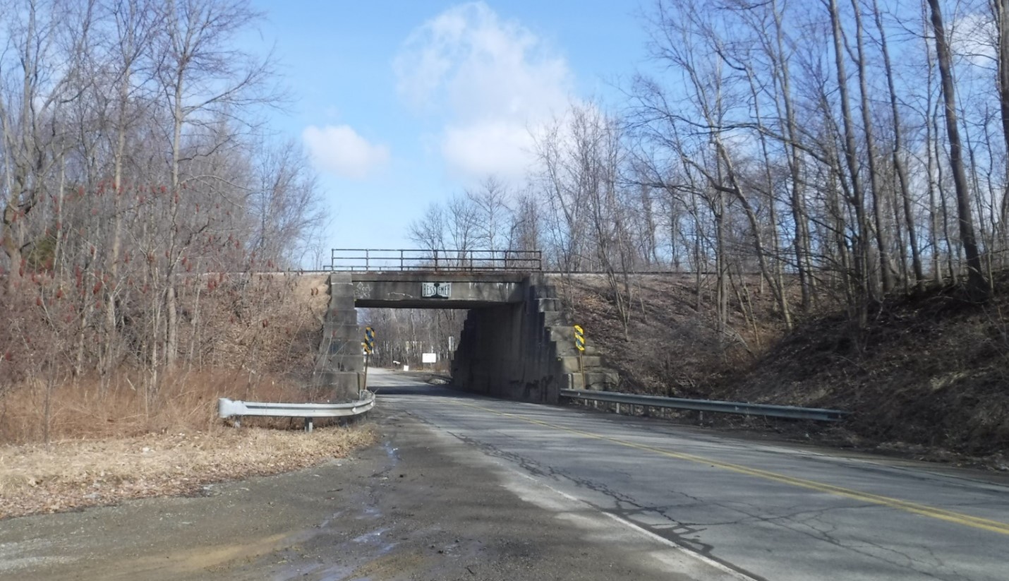
The project proposes the replacement of the bridge that carries Canadian National/Bessemer & Lake Erie Railroad over Route 6N (Route 3006) and widen the roadway near the bridge in Springfield Township, Erie County.
The purpose of the project is to improve the roadway near and under the bridge and increase the vertical and horizontal clearances for traffic beneath the structure. These improvements will allow for the use of this portion of Route 6N as a detour route for Interstate 90 as needed.
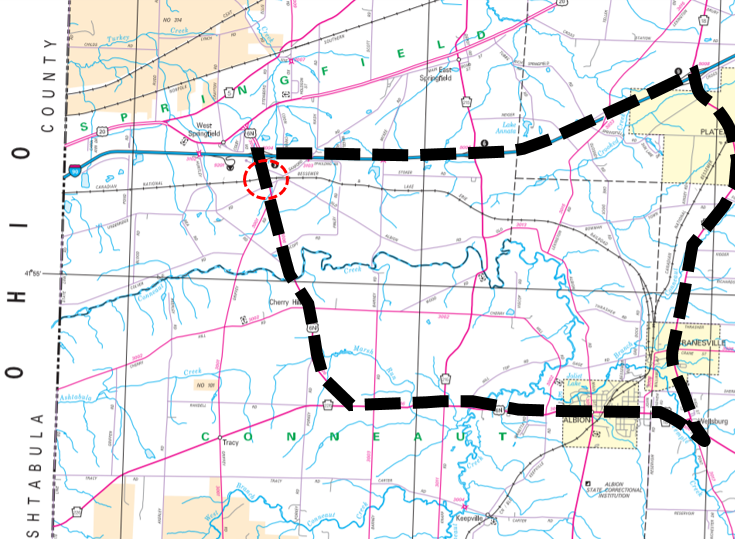
The bridge is located above Route 6N between the intersection with Old Albion Road and the intersection with Sanford Road.
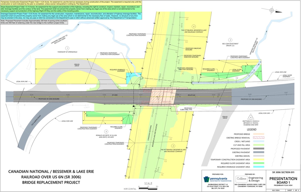
The project will include replacing the existing railroad bridge, widening of the roadway on both sides of the structure, pipe and channel realignment, paving approximately 600 feet of roadway, and updated guiderail and pavement markings. Additional details available in the self-guided presentation and the handout.
Work is expected to occur during the 2027 construction season.
Historical Information
The Bessemer & Lake Erie Railroad is a National Register of Historical Properties eligible historic district and the US 6N underpass is a contributing resource to that district. The underpass will be replaced with a new structure, thereby adversely affecting the historic district.
The State Historic Preservation Office (SHPO) has agreed to the adverse effect. The mitigation agreed upon requires that PennDOT create and house on its website a StoryMap Collection that contains an individual StoryMap for the Bessemer & Lake Erie Railroad. Each StoryMap shall contain a brief illustrated history of the railroad and a discussion of the railroad's significance to the region and to Pennsylvania. The overall StoryMap Collection will be created in a way that other StoryMaps can be added for other railroads that are adversely affected by future projects. PennDOT will provide electronically a draft StoryMap to the PA SHPO and the Consulting Party for a 30-day review period. PennDOT will also notify the PA SHPO and the Consulting Party when the final revised StoryMap is available on the PennDOT website. PennDOT will house the StoryMap on its website for a period of no less than 5 years from the completion of the StoryMap. The StoryMap is estimated to be completed and placed on the PennDOT website during the summer of 2025. A press release will be released when the StoryMap is available for review.
The adverse effect to the Bessemer & Lake Erie Railroad National Register of Historical Properties eligible historic district and the contributing resource of the US 6N underpass is considered a “Use" under Section 4(f) of the U.S. Department of Transportation Act of 1966. PennDOT and Federal Highway Administration have determined that there is no feasible and prudent alternative that avoids the Section 4(f) properties and that the project includes all possible planning to minimize harm to the Section 4(f) properties.
Traffic Impact

A detour will be required during construction and is expected to be in place at various times for approximately nine months. The proposed 21-mile detour route will be posted using Route 6N, Route 18, and Interstate 90.
A temporary rail line, known as a shoofly, will be used to provide a runaround for the railroad while the proposed permanent rail structure is constructed.
The existing railroad bridge was built in 1930. It is classified as poor condition. Approximately six trains a day (three during the day and three at night) use the bridge.
Approximately 2,300 vehicles a day use the roadway under the bridge, on average. The current vertical clearance for traffic under the bridge is 14 feet, 7 inches.
Right-of-Way Impacts
Click here or on the picture for a PDF version of the Right of Way information.

Self-Guided Presentation
Click here or on the picture for a PDF version of the presentation.